Poseidon and his sea

Of salt and soda cans, bearded waves and jumping doors.

Tuesday, October 25, 2005

Where do ships go to die?


When I visited Kao-chiung in the early 80's I was amazed by the numner of ships lying winched up on the beaches.
When walking through town, the streetss were laced with shops selling electrical engines, wire, winches, engine parts etc.

When I look through the website created by Greenpeace about the present practices of shipbreaking around the Indian Ocean, it appears nothing has changed on 20 years.

Just page through this site and be amazed/shocked how the big shipping companies make their money at the expense of developing countries and marine life in general. They save about 1 MUS$ per ship in scrapping cost this way.

Saturday, October 22, 2005

Kanrin-maru Festival

When Commodore Perry with four black ships under his command arrived off Uraga in this city in 1853, the Tokugawa Shogunate government under its isoiation policy realized the importance of building up its own navy force and ordered the Dutch government to build a warship. It was the Kanrin-maru (49 meters in length, with 12 canons and three masts). It sailed out from the Netherlands in 1857 and, in September of that year, arrived in Nagasaki where it was used as a training ship. The ship produced various great people; Katsu Kaishu, Enomoto Takeaki and other important persons who built up the basis of Japan's modernization.

After the Japan-U.S. Commerce and Trade Agreement was signed in 1858, the Kanrin-maru under the commander of Kimura Settsunokami, carrying a Japanese mission to exchange documents of the ratification of the treaty in1860. Among the mission members were Katsu Kaishu, Fukuzawa Yukichi and John Manjiro.

Leaving Uraga Port on January 19 under the lunar calendar, the Kanrin-maru showed its Japanese flag at the mouth of San Francisco Bay after a 37-day voyage. The Epitaph of the Kanrin-maru's Departure was built in 1960 to commemorate the feat of the first Japanese warship's trans-Pacific voyage. In San Francisco, there is an epitaph commemorating the Kanrin-maru's arrival. The Kanrin-maru Festival has been held in May every year since 1974 as a major event of Yokosuka.

Piet Hein

Piet Hein was a Dutch admiral (1577-1629).
As a director of the Dutch West India Company, in 1628 he captured 22 Portuguese ships off Brazil and a Spanish bullion fleet off Cuba. De Dutch call this the "Zilver vloot". A famous song was written about this event (click on the header). It is being played by a Orchestra in Japan today, and one of the members works for Yokogawa, he asked me to find out more about this event, and the background of Piet.

Piet Hein in the Dutch Sugar trade:
Since the Portugese owned half of the world, and the Spanish the other half, they set up Sugar plants in Brazil, by 1570 they had 60 plants operated by using slaves in place called Pernambuco. That was until Piet Hein landed and took over most of the plants. In the 17th century the Dutch became the center of European sugar trading with over 1000 refineries.

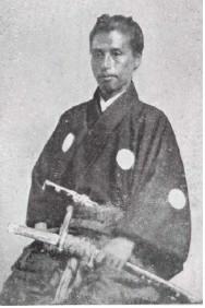
Katsu Kaishu (1/2)

Also known as Katsu Awa or Katsu Rintaro and Katsu Yasuyoshi, was one of prominent statesmen during the end of Edo-Bakufu (Shogunate; Shôgun's government).

He was born in 1823 at Edo (Tôkyô) as a son of a lower-grade samurai, a hatamoto, who trained in Western studies, including military arts.

In his young age he worked as a translator for foreign affairs and put a lot of effort into learning Dutch, English, navigation and Western military science with many hardships.
He studied Dutch because it was the only language at that time which was used to trade with the outside world. The Dutch were allowed as the only foreign country to have a trade settlement in Nagasaki.(Dejima). He went for 5 years to Nagasaki to be trained in the use of ships and naval techniques. He was the first Japanese to learn how to navigate the big Dutch sailing ships

Katsu had initially requested a prominent doctor and Western scholar for permission to study under him. However, the scholar turned Katsu away saying, "Western learning is not suitable for the short-tempered people of Edo," referring to Katsu's birthplace, current-day Toyko. He was taught by Commander Fabius of the Dutch navy under whose command the ‘Japan’ had sailed from Holland.

He was very poor and a Dutch dictionary was very expensive. So he borrowed it from a Dutch doctor He copied it twice which took him one year, and sold one copy to pay the doctor the borrow fee.

Katsu was aged twenty-three when he approached Nagai, having heard of his amicable nature, and began learning Dutch under Nagai's instruction. It was through Nagai that Katsu reportedly met Kuroda Nagahiro, who took a liking to him.
At the same time he intensively trained himself the arts of samurai, zen and kendô.
When he was 27, he opened a Dutch language school to teach Dutch and western military strategy.

On July 8 1853, four black warships with the Stars-and-Stripes appeared near to Edo.
This arrival of Commodore Matthew Calbraith Perry (1791-1858) and his squadron shocked people very strongly, and it triggered off a big change in Japanese history. The squadron called Kurofune ("the black ships") also changed Katsu's life as a Bakufu officer. A report about this event Katsu submitted to Bakufu was recognized highly.
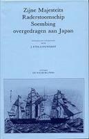
Soon after the arrival of Commodore Perry, the Shogunate requested Donker Curtius to deliver steamships. The Dutch government presented the naval vessel `Soembing`, renamed in Japanese `Kanko Maru`. The maritime school of Nagasaki was established for the handling and the maintenance of the ship and armaments. Commander Fabius of the Dutch navy, who sailed the ship to Japan, and his crew were the first teachers, and Katsu Kaishu one of their students. After evaluating the achievements of the `Kanko Maru`, the Japanese government ordered a second ship. Originally named `Japan`, it was renamed on its arrival in Japan into `Kanrin Maru.
Aboard the `Japan` were first engineer Hardes and medical doctor Pompe van Meerdervoort who set up a hospital during his 5 year stay. Pompe also introduced the wet-plate photography to Kyuichi Uchida, who later made the first picture of of the Emperor.

The 'Pompe Hall' was built to commemorate him in the Nagasaki University's Medicine Faculty in Sakamoto-machi, Nagasaki City

According to the '400 Holland-Japan relations' study, Hardes founded the first ship repair yard and steam engineering factory which was the origin of Mitsubishi.

Het Duyfken

Look at this beauty! Isn't it sad that she is lying rotting away in Australia, no funds to keep her afloat!
A very interesting site, telling the story of the ship Duyfken which was the first European ship to visit Australia.
After it returned from the 'Voyagie' to Holland, it is reported that "the ship will be taken out of service immediately, the rig removed and the hull tied up at Fremantle Fishing Boat Harbour until a decision is made on her future."
Help restore get funding for her!
Write to your newspaper and send a mail to the this address: Email Duyfken!

De tien geboden (voor meevarende vrouwen)

Meevaren wordt door echtgenotes van zeevarenden gelukkig gezien als een voorrecht. Dit meevaren is niet altijd rozegeur en maneschijn. Als er problemen ontstaan dan is het doordat de meevarenden niet voldoende weten wat er wel en niet van hun verwacht wordt.
Hier volgt de beroemde lijst, opgesteld met behulp van meevarenden en vele deskundigen:

1) De echtgenotes aan boord hebben geen rang.Ze hebben dus ook niet de rang van hun wederhelft. De vrouw van de tweede is niet 'hoger' dan de vrouw van de vierde. Het respect dat zij ontvangen wordt bepaald door hun 'vrouw' en 'gast' zijn, door hun leeftijd en door het respect dat zij door hun optreden verdienen.

2) Niet bemoeien met het werk aan boord. Geinteresserd zijn, vragen stellen.... graag! Maar geen bemoeizucht. Ook al zouden drie dagen achtereen de aardappelen aangebrand zijn, dan nog niet naar de kok lopen en zeggen hoe aardappelen gekookt moeten worden. Ook niet klagen; laat dat maar aan de bemanningsleden over.

3) Er gaat altijd wel eens iets mis aan boord, er worden natuurlijk wel dingen gezegd, die beter niet gezegd en gehoord hadden mkunnen worde. Wees als meevarende echtgenote geen klikspaan. Fungeer niet als het paar extra ogen en oren van uw man.

4) In de mannengemeenschap op een schip is de invloed van een enkele vrouw aan boord onvoorstelbaar groot. Wend die invloed ten goede aan. Roddel bijvoorbeeld nooit. Als anderen roddelen, trek u zich dan taktvol terug of probeert u het gesprek een andere wending te geven. Heb met uitzondering van uw echtgenoot, geen nadrukkelijke favorieten aan boord. Vorm geen exclusief groepje om u heen, dat in de bar luidruchtig en uitbundig de boventoon voert, dat de anderen het gevoel geeft dat zij er niet helemaal bij horen. Zo'n enkele vrouw moet bijna de instelling hebben van een hostess; zijn moet harmonie en goede sfeer scheppen en bewaren. De vrouwen aan boord kunnen er door hun takt toe bijdragen dat de reis voor iedereen aan boor prettig is.

5) De meevarende echtgenoot behoort door haar man voorgesteld te worden aan de gezagvoerder en bemanning, althans voor zover zijn daarmee in contact komt.

6) Bemanningsleden die s'achts gwerkt hebben slapen overdag. Zorg ervoor dat kinderen die meereizen zich 'koest' houden in de gangen en er niet rennend en schreeuwend krijgertje spelen.

7) De hutten worde schoongemaakt en enigzins opgeruimd. Maae een hut die door twee mensen bewoond wordt is een stuk bewerkelijker. Van de meevarende echgenote mag worden verwacht, dat ze zelf ook de hut een beetje netjes houdt.


8) De echtgenotes moeten zich realiseren dat hun man vaak geen tijd heeft om te passagieren als het schip in de haven ligt. Juist dan is er veel werk te doen. ALs hij u alleen de wal op laat gaan, is dat geen 'in de steek laten' van hem. Vraag meteen even rond of u voor opvarenden die niet de wal op gaan nog inkopen kunt doen.

9) U kunt er rustig van uitgaan dat aan boord van een schip niets geheim kan blijven. Het is daarom beter ook niets te doen en niets te zeggen dat niet door het hele schip geweten mag worden.

10) Nogmaal, ten ovevloede misschien: een vrouw aan boord heeft een grote invloed. gebruik die invloed zo, dat de bemanning u aan het eind van de reis node ziet vertrekken.

Monday, October 10, 2005

Latittude


In c. 850 Arabs invented the astrolabe, which allows mariners to use celestial navigation to determine latitude.
The principle is still used in todays navigation (or at least taught in Nautical College). You measure the height (or altitude) using a sextant when the sun passes its highest point, and deduct that from 90° and add the sun's declination which can be found in the almanac (with date). Et voila: Lattitude!
Now just cross the ocean steering course 90 due East (or 270 due West). Keeping the sun at the same height would be the confirmation that you maintained the same lattitude. Currents or drift from the winds? Just steer a few degrees into the wind and check the next day what the result is.

This can also be done with stars at night.

You can download an instruction manual to make your own!

Marco Polo and the sea

The pax mongolica between the Christian Europeans and the Mongols created an opportunity for trade. The Himalayas and Gobi desert were natural barriers between Europe and Asia so the trip on the Silk Road took 5 YEARS! Niccolo and Maffeo Polo visited China in 1271 and stayed for 17 years in China including Nicolo's son Marco Polo, in the service of Emperor Kublai Khan who established the Yuan dynasty (1279-1368).

They left China when Kublai became 80 and without him it would be risky to stay. The Polos sailed south, escorting the 17 year old Mongol Princess Kokachin headed for marriage in Persia, and stayed in Sumatra to avoid the monsoon. Here is where Marco noticed that the North Star, or the "Phoenician Star" disappeared below the horizon.
When they reached Persia, they found out that Arghum Khan has died, so Arghum's son Ghazan got lucky. On their way to Venice overland, they got robbed in Turkey arriving home in 1295.

The Silk Road lost its importance only when Vasco daGama went around Cape Horn. Europe to the Cape took about 6 months, and another 6 months to get to the East Indies. This was still much better than 5 years on the Silk Road!

Thursday, October 06, 2005

Navigation lessons

Now this is a useful site. In simple words it explains the basics and it is really well done.


Its got lessons on Positions, Charts, Compass (including some history I also wrote about), Plotting, Pilotting, Tides, and prediction, Currents and navigational aids.


Click on the title, have a look for fun!

Wednesday, October 05, 2005

The ark of Noah and Darwin


What did you think it was about?

Tuesday, October 04, 2005

Navigation: Phoenicians (1400 BC)


It was 1400 BC, the time of Babylonians, Zanzibar and Ceylon. Solomon and David ruled in Biblical Israel. The Minoan civilisation was destroyed and Egypt (Queen Hatshepsut) in decline. The Mediteranean was open for a new sea power. The Greeks and the Phoenicians.
The Phoenicians were initially coastal traders. When storm came, they ran their ships aground. When the weather cleared they would float them again. They ventured beyond the coast navigating on the pole star and other reliable celestial reference points. The Phoenicians are credited with deviding the circle into 360 degrees!

Carthage, a Phoenician colony, was the power in 260 BC. The romans had no idea how to sail, and the Senate ordered 120 ships. During the 2 months it took to build them, Gaius Cornelius Scipio trained the crew and became the first Roman Naval commander.

[post scriptum: A Cornelius....hmmmm. At least we know where 'gaius' comes from. (Dutch for "scum o'the earth"). The famous Romans Julius Ceasar and Augustus were also called Gaius! but OK, that has nothing to do with Navigation]

Pillars of Hercules


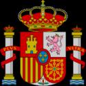
The coat of arms of Spain shows the 2 pillars.
Hercules tore apart the rocks which had before divided the Mediterranean Sea from the ocean. A beacon for mariners since the dawn of seafaring, the famous Rock Gibraltar (or "Gib" as she is called by the poms) was one of the Pillars of Hercules and Monte Hacho in Ceuta, formed the other.

The pillars were named during Hercules performing one of his 12 labours, move some cattle. He had to cross the heap of rock, once called Atlas before he looked at Medusa's head. He must have been lazy because instead of climbing he decided to cut it in two and let the water from the Atlantic flow into the Med, hence two pillars. Gib and Monte Hacho.

For the ancients they marked the boundary of the world as they knew it.
Today? A great pub in London on (where else) in 7 Greek Street. Just follow the link. I heard of this pub from Charles Dickens.
Quote: " Referred to by Charles Dickens in A Tale Of Two Cities, there has been a Pillars of Hercules on this site since 1733, the present pub dating from 1910 although it's stylised to look much older. When Dickens knew this pub the chances are it wasn't full of crusties and dreadlocks, as is it today."

Crusties! what kind of type is that? "a young person who does not live in a way that society considers normal, typically with untidy or dirty clothes and hair, and no regular job or permanent home".
My kind of bar! Feel right at home.

Now back to Hercules. I guess he pushed down Atlantis when he opened the Med by pushing "Gib" aside. Thats another story

Sunday, October 02, 2005

Willem Barentsz


When looking at the arctic map you find the Barents Sea, named after an illustrious Dutchman born on the isle Terschelling, who set out to find a way north to the spice islands. He got his ship stuck in the ice near Nova Zemlya, where he built the 'Behouden huis'. The sad part is that he only became famous because his trip ended so badly; the house was found completely intact in the nineteenth century.


Because Willem found many whales in the arctic, whaling started to become serious business in the early 17th century with Smerenburg ("Blubber Town") on Amsterdam Island in Spitsbergen as one of the main centers. The Northern Company, a combination of trading cities in Holland, Zealand and Friesland, had the monopoly until 1642. Oil at that time was scarce and expensive. Also the herring fishing was not doing well so many fishermen started whaling.
This lead to the Dutch virtually monopolising the Whaling industry in Europe. In 1600 the Dutch had over 10,000 merchant marine vessels. The Basques had invented deep-sea whaling and the Dutch had trouble with knowledge management! The Basque didn't want to teach the Dutch how they did it.

Years later a whaling company 'Vinke&Co' named two factory ships after him (1946-60). The last was sold to Japan and broken up in 1966 as the 'Nichei Maru'.
When whaling ended, Vinke& Co bought Bulkcarriers which were managed under the Company Oostzee.
In 1980 a young Frisian apprentice, straight from the nautical college 'Willem Barentsz' on Terschelling, made his first voyage on one of these ships, the rusty Britsum. [Amsterdam - Newfoundland].
You can guess who that was....

[note: Click on the image of Willem Barentsz and you will get a nice view from the top of the nautical college, built on the island where he was born.}

Admiral Zhen He and Sinbad


Admiral Zhen He visited many countries among which Australia and sailing aournd the cape of Afrika he sighted America in 1411. When reading the book on him I was awed by the sheer size of ships he had built, clearing the hilltops from trees. Look at the difference with the Spanish galleons of that century!

Sailing with him was a man called Sanbao who accuratly drew many maps. He is said to be the legendary Sinbad the sailor!

Compass and rudders

The compass was probaly first made in China during the Qin dynasty (221-206 B.C.). Fortune tellers used lodestones for constructing their boards and earning their fortunes. Magnetite, or another word for iron ore, aligns itself to the poles. The Compass was created through floating the magnet, or centering it on a reed. Merchant ships were able to visit Saudi Arabia in the 12th century.
Adm. Zhen He made use of this to navigate made the discovery possible of Australia and America in 1411. Read the book on this great sailor!

The compass arrived in Europe around 1190. The sailors crossing the Mediteranean in those days had nothing else but the stars to navigate by at night when the coastal lights dissapeared behind teh horizon. For them it was a welcome device when navigation became difficult without stars to lead them. Church carvings in Europe showed the rudder for the first time around the same time.
At that time the size of ships and the height of the freeboards increased, oar type rudders had too steep an angle. The stern-rudder was invented around this time, or copied from the Chinese ship seen in Saudi Arabia. Dont forget that the Crusaders were in Jerusalem at that time (2nd crusade), until they were kicked out by Saladin's muslims in 1187. Also around 1200 gunpowder was introduced in Europe, probably from the Mongols.

Many important ingredients for naval warfare were now known to the Europeans. Some others were missing though: maps, money, focus on expansion.
Only in the 15th century became the real use of the compass known to the Europeans, probably when they got maps of the fantastic travails of Zhen He.

I like the story about that onions were thought to destroy magnetism! Captains didn't alow their crew to eat them.

Sailing the Seven Seas

You must have wondered like me, which were they? I sailed on a few but 7? Here goes....

I believe that the seas meant in this phrase are the ones known in each era.
Lets go back and see what was known at the time great civilisations were at its peak.
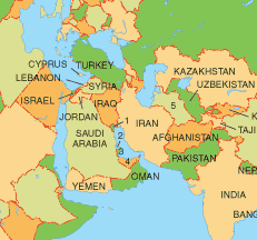
In those days the world was centered around Irak, or the Garden of Eden. Around that area they had several bodies of water (clockwise): Indian Ocean, the Red sea, the Persian Gulf, the Mediteranean, Adriatic Sea, Black Sea and the Caspian Sea.

In the days of Columbus they had added a few, and later on in the days when the spice trades spread from India to the East Indies they were further charted but no 'new' seas may have been found when sugar plantations were set up in the West Indies, with many a Dutchman at the centre of making a good fortune.
The Purtugese and Spanish. The age of discovery. In the days of Columbus and Magelan they knew of the Atlantic, The Pacific, the Arctic, the Indian ocean, and of course the Mediteranean, the Carib and the Gulf of Mexico.
If you'd like to read more on him, have a look at Keith's page. The La Cosa chart is an example of an Italian portolan, originating in the Greek periplus, or sailing directions (still in use today). You can read more on that on early world Maps. There are references to fantastic maps.


I like this one most, Martin Waldseemüller's World Map of 1507.


Lastly there is an opinion that the seas were more exanded toward China Sea and African Seas (West and East). OK.
 
hit counter html code