Sailing the Seven Seas
You must have wondered like me, which were they? I sailed on a few but 7? Here goes....
I believe that the seas meant in this phrase are the ones known in each era.
 Lets go back and see what was known at the time great civilisations were at its peak.
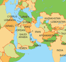
In those days the world was centered around Irak, or the Garden of Eden. Around that area they had several bodies of water (clockwise): Indian Ocean, the Red sea, the Persian Gulf, the Mediteranean, Adriatic Sea, Black Sea and the Caspian Sea.
In the days of Columbus they had added a few, and later on in the days when the spice trades spread from India to the East Indies they were further charted but no 'new' seas may have been found when sugar plantations were set up in the West Indies, with many a Dutchman at the centre of making a good fortune.
 The Purtugese and Spanish. The age of discovery. In the days of Columbus and Magelan they knew of the Atlantic, The Pacific, the Arctic, the Indian ocean, and of course the Mediteranean, the Carib and the Gulf of Mexico.
If you'd like to read more on him, have a look at Keith's page. The La Cosa chart is an example of an Italian portolan, originating in the Greek periplus, or sailing directions (still in use today). You can read more on that on early world Maps. There are references to fantastic maps.

I like this one most, Martin Waldseemüller's World Map of 1507.
Lastly there is an opinion that the seas were more exanded toward China Sea and African Seas (West and East). OK.
I believe that the seas meant in this phrase are the ones known in each era.
 Lets go back and see what was known at the time great civilisations were at its peak.
 In those days the world was centered around Irak, or the Garden of Eden. Around that area they had several bodies of water (clockwise): Indian Ocean, the Red sea, the Persian Gulf, the Mediteranean, Adriatic Sea, Black Sea and the Caspian Sea.
In the days of Columbus they had added a few, and later on in the days when the spice trades spread from India to the East Indies they were further charted but no 'new' seas may have been found when sugar plantations were set up in the West Indies, with many a Dutchman at the centre of making a good fortune.
 The Purtugese and Spanish. The age of discovery. In the days of Columbus and Magelan they knew of the Atlantic, The Pacific, the Arctic, the Indian ocean, and of course the Mediteranean, the Carib and the Gulf of Mexico.
If you'd like to read more on him, have a look at Keith's page. The La Cosa chart is an example of an Italian portolan, originating in the Greek periplus, or sailing directions (still in use today). You can read more on that on early world Maps. There are references to fantastic maps.

I like this one most, Martin Waldseemüller's World Map of 1507.
Lastly there is an opinion that the seas were more exanded toward China Sea and African Seas (West and East). OK.

0 Comments:
Post a Comment
<< Home